
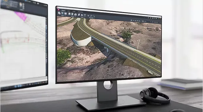
AutoCAD Civil 3D is a software program that enables the execution of design and documentation processes for various civil engineering projects, supporting workflows in terms of BIM.
Why Use Civil 3D?
Enhance Design Operations
Improve productivity and quality with a dynamic environment based on 3D models and a design-based documentation system.
Streamline Collaboration
Access real-time updates and share them with other Autodesk software products for design, analysis, and construction.
Improve Data Exchange
Address complex design challenges through interoperability with other software using common IFC formats.
Create Professional Models !
Learn to Design in 3ds Max with Our Courses
Hosted by experts!
Using Field Data for Linear Works Design in Civil 3D
1. Introduction to AutoCAD Civil 3D
General Overview of AutoCAD Civil 3D
Interface Organization
Workspaces
Locating Work Tools
2. Working with COGO Points
2.1. Basic Aspects of Points
Point Descriptions
Point Labels
Point Work Preferences
2.2. Creating Points
Importing Points from
Various Sources
Description Keys
Point Groups
Point Review and Editing
Point Creation Options
Point Reports
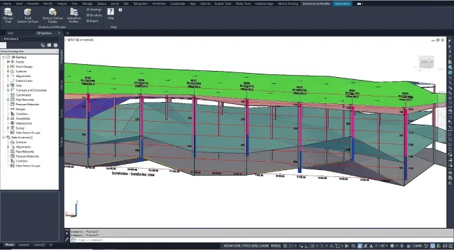
3. Working with Surfaces
3.1. Surface Creation and Analysis
Surface Descriptions
Surface Properties
Surface Analysis
Creating Contour Lines
Perimeters and Break lines
3D Surface Visualization
Surface Display Styles
3.2. Surface Editing
Surface Editing
Adjusting Surface Properties
3.3. Surface Labeling
Contour Line Labeling
Slope Labeling
4. Platforms and Grading
Platform Description
Grading Preference
Settings
Platform Creation Working with Feature Lines
Volume Calculation Tools
5. Working with Roadways
Roadway Creation Process
Description
Overview of AutoCAD Civil 3D
Sites
5.1. Working with Alignments
Alignment Creation
Tools
Alignment Styles
Using Design Criteria
Editing Alignments
Alignment Labels
Creating Alignment
Tables
5.2. Creating Profiles
Profile Creation Tools
Profile Creation Wizard
Creating Natural Ground
Profiles
Vertical Alignment Drafting
Vertical Alignment Labels
Vertical Alignment Editing
|
Ing. Jesús Gonzalez Sales Executive 
664 682 4126 Ext. 1008
jgonzalez@grupolan.com
Monday to Friday
Ing. Rodolfo Hernández Specialized Technician 
664 682 4126 Ext. 1004
rodolfo@grupolan.com
Monday to Friday
|